Friday, June 26, 2015

Day 6 - Tuesday Jun 16 - Little Current / Niagara-on-the-Lake (ON)

Day 6 (461 km)
Tuesday – 2015-06-16
Little Current – Niagara-on-the-Lake (ON)

Great Start to the morning, sun is up and the weather is cool but will warm up, so this will be a great day to be on the bike heading home on my last leg of the Northern Quebec / Ontario Watershed Tour.

Garry' Restaurant
Breakfast is a little place called Garry’ Restaurant on Hwy#6 across from the Shell Gas station corner of Vankoughnet Street, good food and priced accordingly – I like this place. 
On my way by 8:30 I have to catch the 11:10 Ferry at South Baymouth or I will be on the 3:30pm one and I will not make it home in the same day.

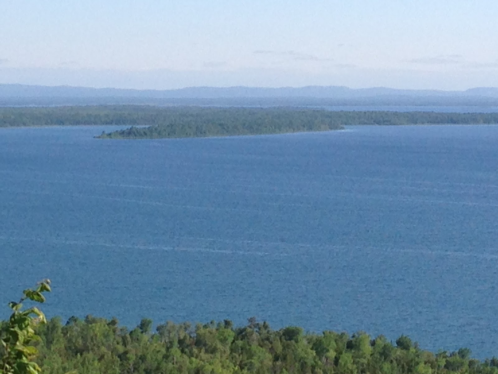
There are two really good photo stops along Hwy#6 one at Pepper Point Road Rest Area with a commanding view of Lake Huron (also known as Little Current – Howland Centennial Museum, which is on the grounds of the rest area).  The other one is High Falls (High Falls Rd, East side of #6, South of the Rest Area above by 8.3km or 24.9km South of Garry’ Restaurant), both these are well worth a stop.
Lake Huron
High Falls (off the #6 Hwy)
I reach South Baymouth around 9:50 with plenty of time to spare (like about an 1 hour), but motorcycles are put on first before cars and are off first at Tobermory, plus the ferry is cheap at $32.75 for passenger and bike, and the two hour ride is just so relaxing – down right civil.  
Bikes about to load on Ferry at South Baymouth
The crossing takes 2 hours and that allows time for lunch on board and a chance to take some photos and video as we approach Tobermory there is a lighthouse to the West on Cove Island, which is part of Fathom Five National Marine Park operated by Parks Canada.
Ferry is docked at 12:55 and there is no delay in the 5 motorcycles taking off, one needs to beat the car traffic to Wiarton, or you will have difficulty to pass all the traffic once it gets spread out on Hwy#6, so no delay – just get moving.  
Lighthouse - Cove Island - Lake Huron
I follow a couple riding from Cold Lake, AB to London, ON, he works for the Air Force and had some good stories of the Russian’s testing Canadian sovereignty in the North, he referred to Canada’s response as “defending the realm”, I like that term.  They turned off in Wiarton into the Tim Horton’s and I continued on south.  I am going to try out a new route that I used in 2011 when I did my Bruce Peninsula trip (www.ontape.ca/bruce) , so I am not going down Highway #6, I will go West on Hwy#21 and then South on Bruce Country #10 Road to Hanover.  After Hanover follow the #10 to Neustadt and then south to Hwy#9 to Teviotdale and follow County #7 via Rothsay and Elora into Guelph.


Just as I approach Chesley I spot a very large turtle on the side of the road at the right edge, on the white line.  I of course stop to see what this guy is up to, turns out this Euclid is a 40lb Snapping Turtle, who has a long tail and makes a quick retreat back to the ditch, but before he gets away there is of course a photo op to be had, I was unable to hold on to this guy he was strong and I don’t think was in the mood to chat, he didn’t snap either – anyway saved another survivor of the age of dinosaurs, and continued on my way.
A large Euclid - was very big and powerful too
I made a quick stop at Royal Distributing to get a pair of waterproof motorcycle gloves by Joe Rocket (also found my pair back at the house) so now I have two pairs.

A quick rundown Hwy#6 to Hamilton and the #403 to QEW and I am home at 7:30pm, tired, bike needs a wash but what a great trip, would do this again in a minute, maybe no rain.
Total trip distance is 2,280km (1,416miles).

A lot of other riders who view the blog always ask about costs for a trip, so here are two tables of Gas and Hotel lodging costs, not included are any meals.

Gasoline Consumption and Costs
Date Location Distance KM Litres Amount
11-Jun Start 69567
11-Jun Barrie 205.6 69772 12.54  $     16.17
12-Jun Orillia 53.5 69825 3.03  $       3.85
12-Jun Bancroft 135.1 69845 7.5  $       9.29
12-Jun Renfrew 135 69980 9.5  $     12.84
13-Jun Maniwaki 158.9 70274 9.1  $     12.35
13-Jun Le Domaine 103.1 70377 6.33  $       8.42
13-Jun Senneterre 200.9 70578 12.6  $     17.50
14-Jun La Sarre 189.5 70768 10.97  $     14.96
15-Jun Timmins 202.8 70970 11.7  $     16.23
15-Jun Gogama 151.6 71122 9.1  $     12.48
15-Jun Chelmsford 140.8 71263 7.3  $       9.91
16-Jun Little Current 123.5 71386 8.3  $     11.48
16-Jun Hanover 214.8 71601 11.2  $     15.11
18-Jun END 245.8 71847 13.5  $     18.06
Totals:
132.67  $   178.65
Average:  $ 1.58 /Litres


Hotel Costs
Location Name Amount Rating
Maniwaki Auberge Du Draveur 147.17 5
Senneterre La Bell Villa 109.23 4
Timmins Super 8 113.55 4
Little Current  Hawberry Motel 100.57 3

Day 5 - Monday Jun 15 - Timmins / Little Current (ON)

Day 5 (418 km)
Monday – 2015-06-15
Timmins – Little Current (ON)

Today’s ride will take us South from Timmins West on Hwy#101 and then South down Highway #144 towards Sudbury, and again some very remote roads with nil services except for the single gas station 120km from Timmins, that is not a problem our bikes have a range of about 280 to 300km, not that we want to try the +300km just in case our calculations are a bit off.

Before departing Timmins I wanted some shots of the old and very large ONR Train Station in downtown Timmins, now modernized and used as the central bus terminal for the City Buses and the ONR long distance buses, wonder what this place was like when the Northlander and the overnight train to/from Toronto still operated.
Timmins x-Railway Station now a Bus Terminal
One thing about Timmins is the streets have no (as in nil) street lane or lines whatsoever.  The winter conditions are so extreme in these parts that the lines are literary scraped off the roads by plows, sand and salt.  It just adds another challenge to our trip, once out of the city there are “some” marking but not much on the #101 either, in fact since leaving Quebec, I would say there has been a noticeable drop in the quality of the roads in Northeastern Ontario.

Our first stop on the ride south from Timmins is about 110km at the town of Gogama, on the mainline of Canadian National Ry, also this area saw TWO oil train derailments in the Winter of 2015, one was located close to town the other “out there” in the bush some 35km to the West.
Gogama, ON E/B CN
As luck has been in our favour on this trip, upon our arrival we catch an Eastbound, and get it crossing the Minisinaka Lake on the causeway, not the best shot but there was about 2 minutes to get a photo at all.  This spot would be great for a Westbound, but lots of trees reduce the view and the time here is to be one hour.  We return to the level crossing at Miller Street (Hwy#661), were we get an Eastbound and then an Westbound (Hot Shot Train #111 which is all double stacks with a DPU about ¾ in), we hear on the radio that another Westbound is coming but after deploying the standard 15 minute CRHA rule, we have to be off on our way. 
Gogama, ON W/B CN #111

We stopped briefly at the Arctic Watershed sign/location which separates the height of land between what flows to the Atlantic and Arctic oceans, it is also about 1 1/2km from our lunch stop at the junctions of #560 and #144, the restaurant / Gas station / bus stop is also called The Watershed (Truck Stop) with a location of Gogama, even if with are 20km from there, named only because there nothing else out here.
Arctic Watershed on the #144 Hwy neat Gogama


The HOOT, who did the trip as well
Ben and Ken at the Watershed Marker on Hwy#144 Gogama, ON
This is also a major truck stop and a cross roads with the Sultan Lumber Road which is like a continuation of the #560, except it is dirt, and probably not the best for motorcycling for big cruisers that we have.

After lunch we push on down the #144 our next locations is about an hour away is Cartier, which is a Canadian Pacific Ry Division Point.
CP Cartier, ON Station

 Arriving in Cartier which is also a stop for the tri weekly VIA RDC Car from Sudbury to White River, another train for remote and northern communities, there is NOTHING happening, no trains in the yard, no power waiting for assignment – nothing, the yard office on the second floor of the station is open, but looks like no one is around, this will be a brief stop get some photos and we are off, plus the sun is out and it is getting warm, and the traffic on #144 is increasing as we are on the Northwestern edge of Sudbury.
The #144 ends at Lively where it meets the #17 (Trans-Canada Highway) this is where Ben and I separate, with Ben returning to his home in North Bay and I proceeding West and South to Little Current on the North end of Manitoulin Island.

I make a brief stop at McKerrow which is the junction of the former CPR line into Espanola and the current operator Huron Central keeps it locomotives on the wye track.
Whitefish Falls
Always a great photo location is Whitefish Falls, South of Espanola to the right when you are southbound on Hwy#6.
Huron Central Ry - McKerrow, ON

I arrive in Little Current at 6:15pm which made for a long but very pleasant day.  Plus the sun came out back in Cartier and it never rained.

Met two other motorcyclists from Barrie who were heading for Michigan and doing US#23 along the Lake Huron coast, did that back in 2007, but it is still a great ride.  Had Diner with my new fiends at the Anchor Inn Hotel (I think it was the only place open in “downtown”), the town was dead, and I was told that the place comes to life once the Michigan schools are out for the Summer, lets hope so they need customers.  But the white fish was great and I welcomed the conversations from fellow motorcyclists.

Overnight accommodations: Hawberry Motel, just make sure you get the rate in advance in email, this guy tries to “adjust” the rates on your arrival, room was clean, but I will not be ripped off.
Anchor Inn and Hotel - Little Current
Weather: Cloudy to start 15c, Sunny and 24c by late afternoon.


Tuesday, June 23, 2015

Day 4 - Sunday - Jun 14 - Senneterre (PQ) / Timmins (ON)

Day 4 (385 km)
Sunday – 2015-06-14
Senneterre (PQ) – Timmins (ON)

Today is the “big day”, having ridden 1,100km to reach Senneterre in rain and etc.  We were not going to miss the departure of VIA Train #606 (The Abitibi) one of the few remaining VIA services designated for Northern and Remote Canada.  This trains runs three times a week from Montreal to Senneterre and return, the key is that on Sunday it departs at 08:45 vs 05:45 which is much better light for video and pictures.  That was the whole purpose of being in Senneterre for the Sunday morning, in fact the entire trip was designed for this one event.
VIA#606 Senneterre, Quebec

Use this link to view the 2:35 minute video of train #606 departing Senneterre.
https://www.youtube.com/watch?v=pYSX_a12tDo

Ken on the Bridge getting ready to Film train #606
Ben and I took up a strategic position on the road bridge over the tracks which is about 100m to the East of the station, and the light was excellent for the shots we wanted.  We arrived about 8:15am in time to see the train proceed from the yard and take position at the station.  There are a fair number of passengers for the Sunday trip South, there are two coaches and one baggage car.  For some not familiar with this service, it exists to supply access (passenger and freight) to remote lodges along the line, and is designed to come North on Friday and return on Sunday, the later time allows for tourists to have an extra 3 hours at the lodge.
Ken at the Senneterre Station (PQ)
Right on time (08:45) VIA Train #606 departs with a standard two blasts from the horn it is off, our video is rolling and the Nikon D200 is set to high speed shutter and it is clicking away, Ben is covering this as well on his iPhone, so as I say “we got this covered” .  We also had coffee and muffins from the local (and maybe the only palace open) Shell Gas station, served and consumed on the bridge.

After all this excitement it was time to resume some serious riding, we have to be in Timmins before night fall, you never ride in the North after dusk, too much wildlife on the roads.

We are going to follow the CN Taschereau Sub Division to the end at La Sarre, that is now the end point on a proud line that built this country and went on to Cochrane, Ontario. We are going to be looking for old station and find two still on the line one a Amos, still with a VIA Rail sign and Macamic (not to be confused with MicMac).  
Amos Station (PQ)
Macamic Station (PQ)
Hwy #111
After leaving Amos on Hwy#111 about 500m down the road a large (probably about 800lbs) Black Bear cross the road, running so he/she is aware of traffic, good just another issue we don’t have to deal with this morning.  Ben has a luggage strap malfunction a little past Amos but this is resolved quickly with one of my “emergency” bungee cords and we resume of travels.
Straight and Long Hwy#111
There are some straight and long roads on this section of #111, as you will see in the photo.
After lunch at La Sarre we are now going to head South on #393 and then West on #388 (to Ontario #101), there will be no services, no towns for the next 100km until we reach Matheson, Ontario.  We will find another Black Bear this time sitting on his rump on the side of the 101 just watching the traffic pass on a cloudy afternoon, one can’t help but wonder what he/she is thinking of the few cars and the odd motorcycle passing through this wonderful dense forest of pine, streams, rivers and the occasional dirt road leading into a Gold mine.  There are lots of Gold mines on the Ontario side of the border, can’t help but wonder if these are producing or just some grand speculation scheme.
Ken at ONR Matheson, ON - Log Cars in Background

ONR Station - Matheson, ON
We reach Matheson at around 3:30pm, just in time to suit-up in rain gear, but this time I am determined to keep my gloves dry, outcome the MEC Gore-Tex palm over mitts, but the rain stops in 5 minutes.  Get a few shots of the ONR Matheson train station, now closed, even the ONR bus doesn’t stop at the station, goes to an “agency” in town, another blow to the North.
Hwy #101 Ontario / Quebec Border
Arrive in Timmins at just a little after 4:30pm and glad to see the Super 8 Motel which we were upgraded to a “superior” room, this place was total renovated about 4 months ago, it is clean and a comfortable place to stay, if you need confirmation that you are North of Bloor St, the sign on the door going to the parking lots reads “Waring Bear”, so there is a bear in the parking lot, so.

Thus ending probably one of the most fantastic motorcycle rides so far this year.

Weather: Sunny to start (19c), cloudy and rain at the end at 20c

Sunday, June 21, 2015

Day 3 - Saturday - Jun 13 - Maniwaki / Senneterre (PQ)

Day 3 (310 km)
Saturday – 2015-06-13
Maniwaki – Senneterre (PQ)

Wow!! Bright Sunshine for our start this morning from Maniwaki, heading North through Réserve faunique La Vérendrye, provincial park. Our first stop will be at Chutes du lac Roland (which are a great set of waterfalls at the end of Lake Roland.  The Trans-Canada Highway (Route 117) through the park is 178km or just over 110miles.
Roland Falls
Our Gas stop will be at Le Domaine which is about 1/3 through the park, there is a restaurant and gas station on the lake, but it is better to have a full tank then to run short (ie out of gas) in the middle of nowhere, from this point we only have about 200km to Senneterre. 

Lunch will be at the North entrance to the Park not far from Val-d’Or at the Royal Motel / Bar 117, lots of other bikes are stopping here as well, and it turns out to be a decent place to stop, we will not need gas as we are now only 40km away and about 30minutes to Senneterre our overnight destination.
Royal Motel / Bar 117

After checking in at the Motel La Bell Villa (which is the best place in town) and dropping off all the motorcycle luggage etc plus hanging up gloves from Friday that are still note dry.
Our next stop is the abandoned Canadian Forces Station – CFS Senneterre which was part of the Pinetree Line or the southerly line forming part of the DEW line (Distant Early Waring) which were radar sites trained to the North to watch for incoming Russian misses and aircraft.  
Old Radar Site CFS-Senneterre

Old Radar Site CFS-Senneterre
Old Radar Site - Main Buildings CFS-Senneterre

Old Radar Site - Church/Community Centre CFS-Senneterre
Senneterre Topo Map of the old Pinetree Line Base

CFS Senneterre ca.1959 showing the admin building and the Domes on the hill above
Most of the Pinetree Line sites sit along the 50th parallel, about 150 miles apart from each other, there were over 40 sites at one time.  Little by little I am exploring each site as part of my motorcycle trips.  Found some old 1959 B&W photos on the Internet of the base which help show the site without all the overgrowth of today, note 3 domes on Mont Bell.

After the CFS Senneterre visit Ben and I do a quick review of the railway bridge which will be the site of the Sunday AM photo shoot and do a quick tour of Town before when park the bikes and find an Italian place to eat (called Le Mateo), which was an excellent choice and one I would recommend. 
Welcome to Senneterre - my Bike in the foreground
La Bell Villa Motel in Senneterre
Weather: Sunny, Warm 24c, low humidity 

Day 2 - Friday - Jun 12 - Orillia (ON) / Maniwaki (PQ)

Day 2 (448 km)
Friday – 2015-06-12
Orillia (ON) – Maniwaki (PQ)

This day is going to be a real challenge, I depart Orillia (at 8:20) in a light rain and as I progress Eastward the rain becomes heavy and steady through to Bancroft.  After a Gas stop in Bancroft I am on my second pair of gloves and the leather dye is coming off on my hands, but I push on into the flat gray sky.  The rain becomes light as I approach Renfrew at around 1pm, which is the meeting and lunch point for Ben, who is coming in from North Bay, other than the odd iMessage I know he is on his way in the rain as well.

Kinmount Station, Kinmount, ON

Ben and I have not done a motorcycle trip since last year’s September trip to Lexington, KY so there is a lot to catch-up on but in under 45 minutes we need to push on to Maniwaki, our overnight stop.  The light rain continues all the way to Maniwaki, so we do not make the photo stop at the hydroelectric day on the Ottawa River.

Because we used this route last year in June to attend the SCRC Quebec Bash we recognize familiar landmarks, but, the old CN Line from Montreal to North Bays which was still in use to Portage de Fort (in 2014), is being ripped up, I guess the sawmill in Portage has closed or switched over to trucks.

We reach our overnight stop of Maniwaki at 16:30, not bad time for all the rain, and comparing our times from 2015, no difference, so the rain didn’t slow us down after all. 

We are staying at Auberge de Draveur, excellent place with an indoor swimming pool and a Spa and an elevator serving the second floor.  Of note I went through 3 pair of gloves – now total soaked, and I know I have waterproof ones somewhere (I bet at home). 
Hang up all the wet stuff and head for dinner around 7pm in the hotels dining room, nice to be dry and warm.

Then on Friday I will continue on to Quebec via Bancroft and Renfrew.  I will meet up with Ben in Renfrew for lunch as we do now each year, we have the timing down so that the longest wait is 15minutes for whoever arrives first.


Weather RAIN all day +22c

Day 1 - Thursday - Jun 11 - Niagara-on-the-Lake / Orillia ON

Day 1 (264 km)
Thursday – 2015-06-11
Niagara-on-the-Lake – Orillia (ON)

Enjoyable ride from Niagara-on-the-Lake to Orillia via the QEW, 407 and 400 highways, traffic was OK but the 400 is a busy 3 or 4 lane race track one needs to keep on alert. There is always the annual stop at Flags Unlimited to purchase a new flag, which will be used starting in the Spring of 2016, the store sells “seconds” at half price and because we have a large 22ft commercial flag pole in front of the house I need a large flag, so the “discount” is a requirement.

Karen is here for the annual Canadian Authors Assoc Annual Meeting and conference and I usually attend some of the evening events as I will tonight and stay over.

The hotel we stay it is the Best Western Mariposa Inn, which is about 1km from the OPP GHQ, this year the hotel is full of OPP Golden Motorcycle Team members who are doing VIP security training (as they did last year) for the Pan Am Games starting in Toronto on July 10th.

Then on Friday I will continue on to Quebec via Bancroft and Renfrew.  I will meet up with Ben in Renfrew for lunch as we do now each year, we have the timing down so that the longest wait is 15minutes for whoever arrives first.


Weather so far is warm +26 and sunny.

Trip Synopsis

Trip Synopsis

This is a one week motorcycle trip to Northern Quebec and Northeastern Ontario, with one of the highlights is seeing one of VIA Rail Canada’s Remote and Northern Service Trains.  Train #606 (the Abitibi), this train and #604 operate only three times a week (Montreal to Senneterre), and on Sunday it leaves Senneterre at 8:45 vs 5:45, which improves the daylight photo and video.

There is also one additional Pinetree Line Radar site to visit at Senneterre, and after that I will have been to 8 sites counting this one at Senneterre.

Senneterre is not the end of the line, in fact the line through Senneterre formed the NTR (National Transcontinental Railway from Quebec City all the way to Vancouver, and was the fastest route to the Atlantic for western grain from Manitoba and Saskatchewan.  In early 2000 the line was severed between Cochrane, Ontario and La Sarre, Quebec, which ended the once a week train from Cochrane to Montreal.

My close friend Ben Gerard (of North Bay) will be joining me on this 2,200km travel through the spectacular scenery of Northern Quebec and Norther Ontario, along with the HOOT as it is his turn for a trip.


Ken on the Watershed Tour 2015 - Northern Quebec and Ontario